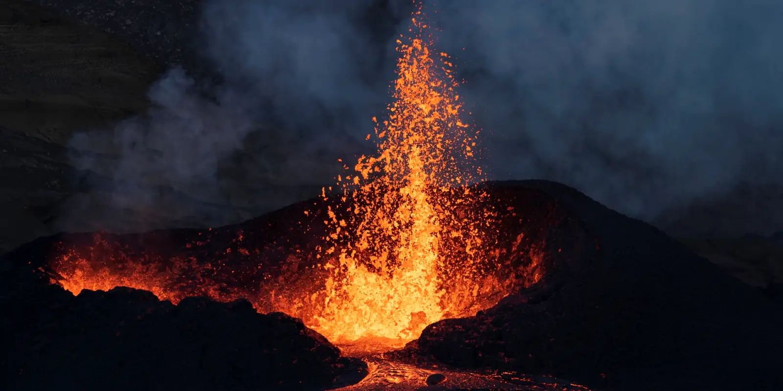
Mauritius, a Mascarene island in the Indian Ocean, with a latitude of -20° 12′ 23.94″ S and a longitude of 57° 40′ 31.80″ E, was formed around 10 million years ago by an undersea volcano. A huge eruption took place on the floor of the Indian Ocean, as a result layers of lava formed our island. The eruption collapsed to form a caldera, and later on from those activities, it formed a plateau. The beautiful mountains and hills englobed with basalt rocks and soil present in every district all originated from gigantic lava flows. Even through several thousands of years have passed since the last volcanic activities, few volcanic craters and cones have remained as footprints, which this article will make you discover.
ATTENTION: This is a discovery article rather than a scientific one. The purpose of this article is to make people discover the popular craters we have on our island.

A Quick Overview On Volcanic Cones With Crater & Without Crater
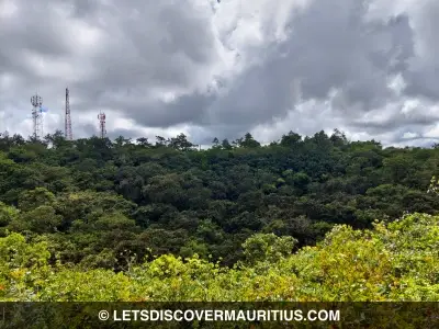
You will be surprised after believing our small island is composed of more than 20 volcanic craters and cones. The mountains and hills you see around are examples of volcanic cones. In the world of volcanology, there are different cones, such as stratocone, spatter cone, tuff cone, conder cone, and rootless cone.
Volcanic cones often have a crater. A crater is a circular hole in the ground of the cone formed due to volcanic activity. It can be empty, filled with snow, constitutes vegetation, and finally, filled with a lake. As you probably know, most of the volcanic craters in Mauritius include dense vegetation or a lake.
There are volcanic cones that do not have a crater. They just look like a hill, covered with trees. You may not differentiate them from mountains or hills, because they can look the same.
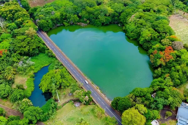
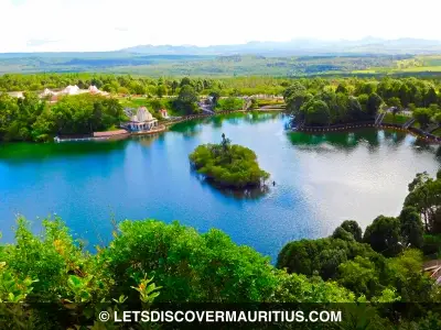
Trou Aux Cerfs
Situated around 605m above sea level in the district of Plaine Wilhems, in the beautiful town of Curepipe, the Trou Aux Cerfs is the most famous volcano on our island. In the early 1800s, Trou Aux Cerfs was called Tronc Aux Cerfs on some documents. Some reports describe many deers wandering inside the crater, giving us the origin of the name.
It is classified as a dormant volcano, constitutes a crater lake, and has dense shrubs and trees. The crater’s diameter is approximately 350m, and the central depression depth is about 85m. Decades ago, at the bottom of the crater, there were vineyards and plantations managed by the Botanist Lavignac. He even wanted to build his house inside. Some Malagasy slaves used to live nearby as well.
Nowadays, lots of joggers and enthusiasts frequent the place, which turned it great for sightseeing, The tracks to descend to the crater are not that easy. One of them is very complicated due to the dense shrubs and trees. The other track is slippery in rainy weather, hence, muddy and still surrounded by thorny bushes. Some people fish in the lake. The vineyards do not exist anymore, but some ruins have remained, and the crater has been abandoned like a deep pit full of mosquitoes and giant rats, without forgetting the monkeys. However, it does have fantastic flora and fauna. The video below depicts the remained vineyard’s ruins and the crater:
Bassin Blanc
The La Marie road that leads to Mare Aux Vacoas reservoir is calm, and you usually feel a cold wave, particularly when driving. Continuing the road, it passes by Plaine Sophie Nature Walk and goes to Pétrin. You will find a small roundabout on the right that leads to the splendid village of Chamarel. Straight you will descend to Mont Blanc. After several zigzag turns, reach the mysterious crater lake of Bassin Blanc.
Bassin Blanc has a reputation for being a spooky, dark, and dangerous place. There were several corpses discovered there. They were involved in murders and suicides. One of the famous cases was in 2002. Two people were found in the lake, tied to each other, which has caused controversies on the real cause of death, whether it was a suicide or murder.
Bassin Blanc’s last eruption was 20,000 years ago, and an extinct volcano. It is 450m above sea-level approximately. There is a thick forest around it. The exact depth of the crater lake is still unknown. Some scholars say around 20m deep. However, the real figure is unknown. The track to descend to the crater is tricky, and one can get easily lost. When you reach the edge of the cone, you can see from the top the immense amount of trees at the bottom. To reach the lake, there is a high possibility to walk in thick mud, depending on the weather, challenging the dense bushes, and end at the lake. Verily, the atmosphere at the bottom is creepy, similar to a horror movie. This is not a place to wonder if you have a chicken heart!
Trou Kanaka
Further away from Grand Bassin, in the direction of Avalon on the road to Bois Chéri, situates the Trou Kanaka crater. The Kanaka crater was lesser-known until, a few years, its popularity to discover has grown.
It is among the best spots to hike. There are tea plantations in the surroundings and not too far away, which situates the Cascade Kanaka. Moreover, there is even a small cave nearby. A few decades ago, there were railway lines close to it to transport sugarcanes. It was commonly known as the Bois Chéri line.
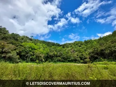
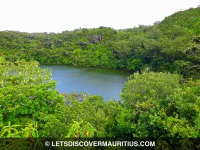
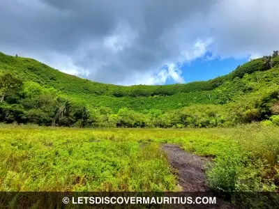
The crater lake originated from an extinct volcano, 700,000 years old. It does not require much effort to descend into it, even if it is a bit slippery. The marshy lake is full of vegetation, so thick that you can jump on it in some areas. Around the crater, there are vast tea plantations. The atmosphere is cold, tranquil, and amazing to be if you want to disconnect from the usual busy life.
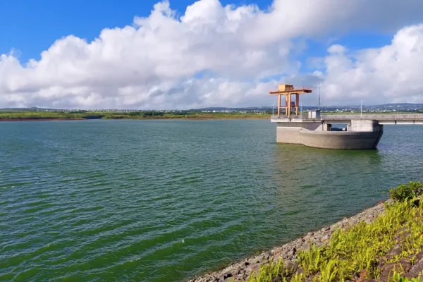
Grand Bassin
Some kilometers away from Bassin Blanc, precisely on the road to Pétrin, the right leads to the sacred lake of Grand Bassin. Grand Bassin, also known as Ganga Talao, is a crater lake from an extinct volcano located 560m above sea level. The weather in the region is most of the time rainy, foggy and cloudy. It is considered a sacred lake by the Hindu community, who every year goes to pilgrimage there on the occasion of the Maha Shivaratri religious festival. The first pilgrimage began at the end of the 19th century and has been going on until today. Grand Bassin’s first name was Pari Talao and later changed in the 1970s to Ganga Talao.
Around the lake, there are spots for devotees to pray. On the other side, there are dense trees and private lands. There is even a small islet in the middle of the lake. It is believed the exact depth of Grand Bassin is unfathomable, but Allistair Macmillan cited in his book, Mauritius Illustrated: Historical and Descriptive; Commercial and Industrial; Facts, Figures and Resources, published in 1914, probably the lake is 16m deep. Grand Bassin first appeared on the map of Jacques Nicholas Belin, in 1753. Few historical reports state slaves used to live nearby back in the French era.
Bar Le Duc
Far from the district of Plaine Wilhems and Savanne, where most of the famous craters situate, there is a small village called Bar Le Duc. Located next to Nouvelle Découverte, on a hill, the crater is on private property where permission is needed to access.
Many years ago, there was a sugar mill in the region known as Bar Le Duc Estate. Now, most of the lands around the estate are sugarcane fields, offering a splendid greenish landscape. Mountain bikers and hikers love this region because of its tranquil and peaceful atmosphere. From Bar Le Duc, you can see Alma Hill (stated further in the article below), Verdun Hill, Deux Mamelles mountain, and a few other mountain ranges and hills as well.
Bar Le Duc is a young crater, 20,000 years ago since its last activity. Surrounded by some native plants and shrubs, it is believed that Bar Le Duc is the smallest crater in Mauritius. Nearby the region, various caves originated from different lava flows. The soil is quite rough and there are basaltic rocks present mostly everywhere there.
The area and the nearby regions have few caves which are hidden in some plantation fields.
Some lesser-known craters in Mauritius
Other than the most popular and mainstream craters, there are several lesser-known craters on our island. Perhaps you are near one and do not know the hill or the lake was a volcano thousands of years ago. Below is a list of less famously known craters to take into account.
Mont Piton
Mont Piton is the highest hill in the North, with approximately 260m in height. The crater is located where a small forest is on a hill.
Butte Aux Papayes Hill
Situated in the North, near Belle Vue Harel, the Butte Aux Papayes’s elevation is around 145m. It was a volcano, and today there is the “Domaine de Hillside”.
Forbach Hill
A bit ahead of Butte Aux Papayes situates another extinct volcano, the Forbach Hill. The elevation is low. The hill is composed of sugarcane fields.
The Mount Hill
The Mount is situated close to Piton Crater. The elevation is low, less than 100m, and with sugarcane fields.
Mon Loisir Hill
Further from Mont Piton, there is Mon Loisir Hill, a low elevated hill, covered with sugarcane fields.
Alma Hill
From the Bar Le Duc crater, you can easily see Alma Hill. Rich with trees, this dead volcano has always been a wonderful scenic view.
Mont Williams
While going to Nicolière reservoir from Villebague, on your left you will see the Mont Williams hill, a dead volcano.
Mont Calebasses
An isolated peak of around 500m in height, and can be seen from Verdun motorway, the Mont Calebasses was a volcano.
Ile D’Ambre
The only islet in Mauritius where a small crater lake can be seen is at Ile D’Ambre. It is also the third-largest national park inland.
Other lesser-known volcanoes in Mauritius are: Trou Raoul, Curepipe Point, Bois Cheri, Butte Chaumon, L’escalier (Nouvelle Découverte), Mont Virer, Malherbes, Tamarin Estate, Trou Bouchet, Mont Perruche, Les Mares, Verdun Hill, and Mare D’Australia Hill.
Another Natural Beauty Facets…
We are fortunate our island is rich with natural beauty. Reputed for its fantastic beaches and breathtaking mountains and waterfalls, there are unpopular natural facets that are still yet to explore. Our remaining craters are great examples! We have a geological part, and our country’s formation itself is based on it. Hopefully, this short article has enabled you to discover a little about our volcanoes.
Author & References

Author: Ali J | Date Published: March 28, 2022 | Last Updated: July 09, 2023
References: Atlas of Mauritius & Rodrigues (ELP), Allister MacMillan (MAURITIUS: Illustrated – Historical and descriptive commercial and industrial facts, figures and resources), Guy Rouillard (Histoire de Curepipe des Origines à 1890), Wikipedia, Some geological documents on Mauritius.
Subscribe For Newsletters
Not just newsletters, but you may enjoy free vouchers, coupons, activity deals and many others while subscribing…